Capture Process and Deliver valuable insights using State Of The Art UAV Technology
CGS are at the forefront of the latest Aerial Mapping technology suitable for use on both small and large scale projects.
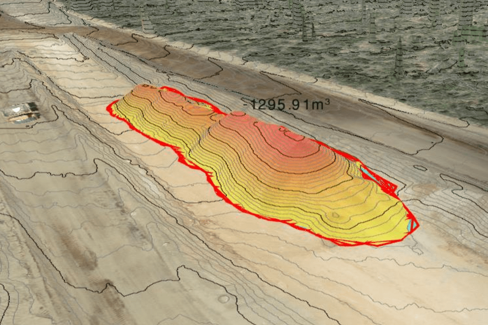
We have the ability to capture, process and deliver high resolution and high accuracy data for areas in excess of 2000 hectares. Using the latest methodologies we can deliver quality products usually within 12 to 24-hour timeframes.
Our deliverables can include:
Digital Terrain Models (DTM's)
Point Clouds
3D Mesh's
High Resolution Colour Imagery
Orthophoto Mosaics
Thermal Infrared Imagery
This data has uses across multiple sectors for applications including:
Volumetric Calculations
Cut & Fill Analysis
Engineering Design
Flood and Hydrological Analysis
Vegetation Assessment
Asset Inspections (Solar, Gas, Power, Industrial)
3D Visualization and Reality Modelling
CGS holds a Remote Operators Certificate (CASA.ReOC.7177) and conducts operations in accordance with its operations manual. As such, CGS can request and be approved to conduct flights in areas that restrict the use of drones.