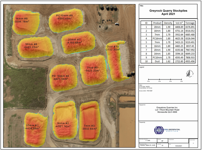
SAME DAY Flight Map & Report

High Accuracy UAV Mapping Volumes Delivered On Site...

CGS are able to offer a unique solution to your quantification requirements. We have developed a system that allows us to fly, map, quantify and report in the same day without reducing accuracy!
Civil Geospatial Services offer:
Flight, Mapped, Reported On-Site That Day
Cheaper Than Traditional Competitors
State Of The Art UAV Technology
Latest Aerial Mapping Software 
Unique Same-Day Processing Solution
High Accuracy RTK GPS Systems
CASA Certified Service Providers

Looking for rapid stockpile quantifications..?

This unique approach is what set's us apart from other services available, both in speed of delivery and reduced costs for our clients.
The management of inventory is critical to running an efficient & profitable operation. Knowing the quantities of products you have stockpiled allows better planning for the extraction and processing of construction materials and ultimately more money in your pocket.

CGS holds a Remote Operators Certificate (CASA.ReOC.7177) and conducts operations in accordance with its operations manual. As such CGS can request and be approved to conduct flights in areas that restrict the use of drones.

If you would like more information or a no-obligation quote complete the few multiple choice questions and one of our representatives will be in touch in our trademark rapid timeframe! Also get a free quote and be entered automatically into our draw for a $150 BWS Voucher*

Kevin McAlpine

ProjectDirector
Martinus

"I had the pleasure of working with the team Civil Geospatial Services (CGS) for many years and across multiple sectors . In my experience, project success is largely based on the accuracy of the survey set out and pick up – particularly the exceptional quality CGS provide every time! CGS are also at the forefront of ever-advancing technology and have successfully utilised drone flights for material movement reconciliation on the delivery of 85km of civil construction on the Carmichael Rail Network project in central Queensland. I am proud to consider CGS a key partner in the exceptional growth of Martinus now and into the future."

Leon Richards

Technical Director & President of the International Pipe Line Contractors Association (IPLOCA)
McConnell Dowell

"CGS has been supporting numerous McConnell Dowell projects since 2008 . The services provided have been professional with reliable and experienced personnel with current Survey Technology always being utilised. This has benefited McConnell Dowell by eliminating costly rework during construction and the ability to provide rapid project close out as survey data quality and accuracy is always ensured."

Johannes Joubert

Survey Manager
Bravus Mining & Resources

"I have had the good fortune to work with CGS for Martinus Rail on the Adani / Bravus Carmichael Rail Project . I found CGS and their staff easy to communicate with and able to discuss the complexities of the project. Tony and his staff are hardworking and do long hours to achieve the best outcome for the project in a very professional manner. I highly recommend CGS to work on any project that requires long hours, complex challenges. I would be happy to work with them again in the future."
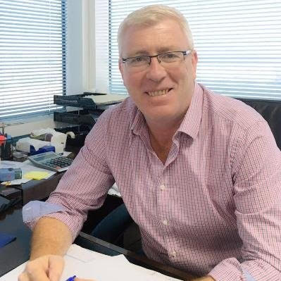
Vince Garde

Director
Arkad Engineering & Construction

"CGS are experts in their field, and bring to a project the ability to quickly identify and resolve potential issues before they become a problem."

Copyright © 2021 Civil Geospatial Services
Privacy PolicyWebsite by EGB DigitalLogin
envelopephone-handset linkedin facebook pinterest youtube rss twitter instagram facebook-blank rss-blank linkedin-blank pinterest youtube twitter instagram